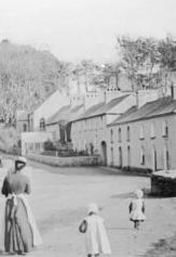
Nestled between the Drum Hills and the River Blackwater, the village of Clashmore is part of a natural landscape which is beautiful no matter what season and is associated with an historical importance which is as fascinating as it is ancient
The best way to experience the rich history and beauty of the area is to follow one of our heritage nature trails, namely the Kilmaloo Walk and St. Mochua's Walk, but of course there are many other historical points of interest around the village which are well worth visiting.
The Kilmalloo Walk is a moderately challenging trail of approx. 8 km in length and takes in such historical landmarks as the Kilmalloo Icehouses and the ruins of Ballyheeney Castle.
St. Mochua's Walk is a gentler amble of 3 km and will take you by St. Mochua's Well, which is near the site of Clashmore House, and continues via Millmount Bridge and ends at Raheen Quay, both a reminder of Victorian times when the Industrial Revolution was in full swing.
Grotto of Our Lady of the Wayside
The beautiful Grotto which stands at the foot of the village was built in 1971 with the help of a huge contingent of local volunteers and it is dedicated to Our Lady of the Wayside. Here you will also find a guide map for the aforementioned heritage walks, both of which begin here at this landmark.
Lime Kiln
Up the hill and a few hundred yards beyond the GAA Club grounds, a fine example of a Lime Kiln is to be seen on the left-hand side. Limestone was quarried locally and burned in this kiln to produce quicklime for spreading on farm land to reduce soil acidity and increase fertility. Sand and dried mud from the bed of the River Blackwater (which is high in minerals and phosphates) was also spread on the land to increase fertility.
Ballyheeney Castle
Set back on the right hand side a few hundred yards beyond Ballyheeney Bridge is the ruin of a notable fortress known as 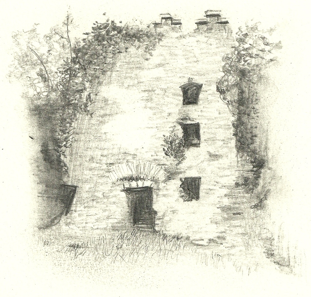 Ballyheeney Castle which was likely a Norman Tower-House and was
reputedly built by a person named Sineach Ruaidh. The history of the castle is vague but latterly it was certainly a stronghold of the Desmonds and in particular was in the ownership of Gerald (Gerrot) Fitzgerald during the 16th century, who was a son of the 3 rd Lord of the Decies, Dromana. Records also show that for long periods of time it was in the ownership of the powerful Ronayne family who presided at D'Loughtane House. Ballyheeney Castle which was likely a Norman Tower-House and was
reputedly built by a person named Sineach Ruaidh. The history of the castle is vague but latterly it was certainly a stronghold of the Desmonds and in particular was in the ownership of Gerald (Gerrot) Fitzgerald during the 16th century, who was a son of the 3 rd Lord of the Decies, Dromana. Records also show that for long periods of time it was in the ownership of the powerful Ronayne family who presided at D'Loughtane House.
A local Seanachai claimed that the castle of Ballyheeney was once owned by an O'Heeny woman who, for her fortune, left a daughter an old horse's skin and as much land as it would cover or enclose. The quick witted daughter cut the hide into thin strips of which she made a rope long enough to enclose the entire townland of Ballyheeney, which thereupon became her property, all 381 acres of it!
Ice Houses
There are at least two ice houses in the parish with the most substantial ones being in the townland of Kilmaloo about two miles southeast of Clashmore Village.
There was a lake known as Kilmaloo Lough which was about five acres in extent and located within 200 yards of the ice house, 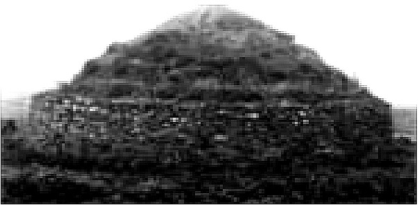 and during winter, when the ice lough was frozen over, the fish merchants of Youghal employed local people to take loads of ice from it and store it in the ice houses. Payment was made at the rate of about six pence for each load of ice taken from the lough, which has long since been drained. Usually two or three men remained inside
the ice house, and as the ice was being thrown in, pounded it with mallets, and so it eventually consisted of one solid block. When the ice was required for fish packing etc., men were let down in a basket on a rope and pulley, and with pickaxe and shovel removed and placed in the basket the amount of ice required. and during winter, when the ice lough was frozen over, the fish merchants of Youghal employed local people to take loads of ice from it and store it in the ice houses. Payment was made at the rate of about six pence for each load of ice taken from the lough, which has long since been drained. Usually two or three men remained inside
the ice house, and as the ice was being thrown in, pounded it with mallets, and so it eventually consisted of one solid block. When the ice was required for fish packing etc., men were let down in a basket on a rope and pulley, and with pickaxe and shovel removed and placed in the basket the amount of ice required.
These houses were in use up to the end of the 19 th century and it was thought that the ice houses were built about the beginning of that century. About that time, the Irish winters became less severe, and less ice formed on the ice lough which was the principal reason for the decline of the ice houses. The importation of ice from Norway continued up to the time that the first ice machine was made in Cork. The fish exporters of Youghal used the ice houses in particular to preserve Blackwater Salmon on their way to market in London and beyond. At the time high society restaurants specialized in Wild Irish Salmon and the quality specimens harvested from the Blackwater were the most prized of all.
Clashmore Fever Hospital (Site of)
Clashmore Temporary Fever Hospital was opened at Ballyheeney in 1847 (in fact located at Lickey Bridge) to meet the ever-increasing needs of the poverty and pestilence stricken local population as a result of the Great Famine which was bearing it's heaviest impact in this year. The hospital was attended at the time by the local Medical Officer Dr. Uniacke Ronyane who was attached to Clashmore Dispensary (a permanent institution which has remained a part of the village ever since). The majority of patients attending the hospital were battling the effects of cholera, many of whom died as a result, and many others with dysentry. The hospital was closed in November 1849 when the numbers of patients being attended to were deemed low enough for future patients to be sent to Dungarvan Fever Hospital instead.
St. Mochua's Well
St. Mochua (or Cronan), a disciple of St. Carthage of Lismore, is the patron saint of the village and founded the monastery and
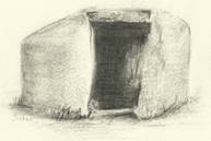 church of Clashmore in the 7th century. His feast day is on the 10th of February and was celebrated locally by people doing "rounds" or praying at St. Mochua's Well in his name. This well is located only a short distance from the village but there is a legend that states that the well was situated where the old creamery was, but when a woman washed dirty clothes in the well, it mysteriously dried up next day and reappeared where it is now! Sadly the Saint and all his household were murdered by either a hostile band of locals or pirates around 631 AD. church of Clashmore in the 7th century. His feast day is on the 10th of February and was celebrated locally by people doing "rounds" or praying at St. Mochua's Well in his name. This well is located only a short distance from the village but there is a legend that states that the well was situated where the old creamery was, but when a woman washed dirty clothes in the well, it mysteriously dried up next day and reappeared where it is now! Sadly the Saint and all his household were murdered by either a hostile band of locals or pirates around 631 AD.
Clashmore House (Site of)
From the 17th to the early 20th century, the village would certainly have been dominated by the imposing presence of Clashmore House which was the seat of Richard Power M.P. who served in successive Parliaments for the County Waterford and was followed in this honour by his son and nephew in later times. It was later the property of Lord Hastings, the Earl of Huntingdon who married the last remaining Power, Elizabeth Anne in 1835. The house is now non-existent after being destroyed over 100 years 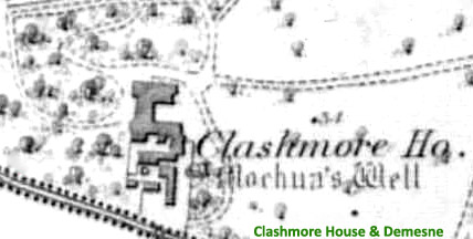 ago
although much of the ornate cut stone from the building can still be seen strewn around the grounds of St. Mochua's Well. ago
although much of the ornate cut stone from the building can still be seen strewn around the grounds of St. Mochua's Well.
Today only it's impressive farm-yard and associated buildings are still extant, but in the 19 th century it was documented that Clashmore House was a richly ornamental first rate house with detached offices. It was erected in 1652 but had since been greatly enlarged and improved by the present proprietor. It has an excellent walled garden, and a very neat demesne of 100 acres. There is a reputed holy well inside of the office yard
The Powers were reported to be popular and fair landlords and of course provided much needed employment for many locals at times when work was scarce and so this landmark is worth mentioning for it's importance in the economic and social circles of Clashmore Village from Georgian through to Victorian times.
Raheen Quay
Raheen Quay, otherwise known as Ballyheeney Quay, was a dock for cargo-carrying lighters on the River Greagagh up to at least 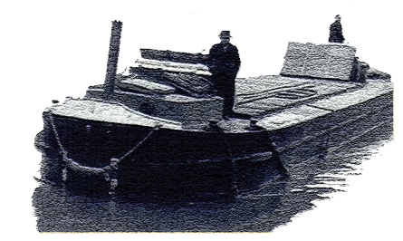 the 1940's when road transport became more mainstream.
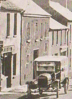
Coal, timber and barley amongst other goods were transported here from the port of Youghal to stock the general stores of the village and barrels of whiskey were brought in the opposite direction from Clashmore Distillery. Not a stones throw away, on the opposite bank, there is another disused quay which served as a private one for the Clashmore House estate, in particular the Earl of Huntingdon latterly used it for his own mooring and those of visitors to the estate. the 1940's when road transport became more mainstream.
Coal, timber and barley amongst other goods were transported here from the port of Youghal to stock the general stores of the village and barrels of whiskey were brought in the opposite direction from Clashmore Distillery. Not a stones throw away, on the opposite bank, there is another disused quay which served as a private one for the Clashmore House estate, in particular the Earl of Huntingdon latterly used it for his own mooring and those of visitors to the estate.
Distillery/Mill
Clashmore Distillery was established in 1825 by Lawrence Dennehy and Robert Power Ronayne, who were both well known 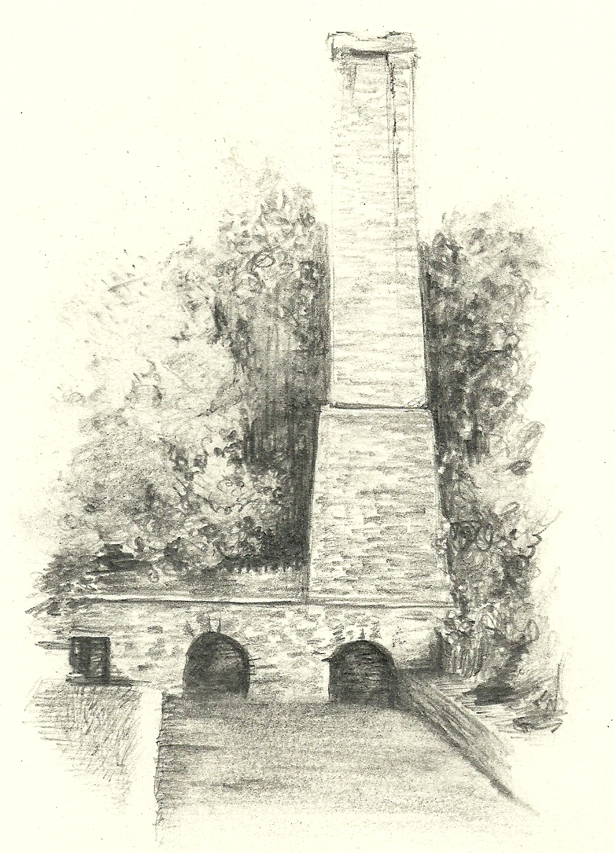 businessmen of the area.
The building is unique in this country as it is the only distillery/mill chimney which actually spans the river which propelled it. At it's peak the distillery produced up to 20,000 gallons of whiskey annually , from malt and raw grain. The distillery had an adjoining house which had a secret cellar where illicit whiskey was stored to avoid excise duty, but it was constantly raided by excise officers, which on one occasion, as the story goes, led to the workers releasing 1,000's of gallons of whiskey into the river and rumour has it that the cattle that drank from the river later that day were all drunk! After this time the distillery was leased to several different tenants, but ultimately the distillery ceased operating around 1840 and was used later as part of the large Flour Mill adjacent to it, which in turn ceased to operate c. 1897. businessmen of the area.
The building is unique in this country as it is the only distillery/mill chimney which actually spans the river which propelled it. At it's peak the distillery produced up to 20,000 gallons of whiskey annually , from malt and raw grain. The distillery had an adjoining house which had a secret cellar where illicit whiskey was stored to avoid excise duty, but it was constantly raided by excise officers, which on one occasion, as the story goes, led to the workers releasing 1,000's of gallons of whiskey into the river and rumour has it that the cattle that drank from the river later that day were all drunk! After this time the distillery was leased to several different tenants, but ultimately the distillery ceased operating around 1840 and was used later as part of the large Flour Mill adjacent to it, which in turn ceased to operate c. 1897.
Heritage Centre
Clashmore Heritage Centre takes pride of place at the head of the village. An abbey was founded on this site by St. Mochua when he built
his monastic settlement 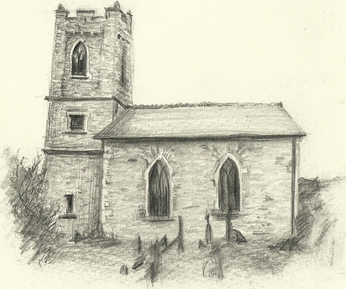 here in the 7th century, and later became the property of Sir Walter Raleigh at the dissolution of the monasteries in 1602. The present structure was built in 1818 from a public gift of £800-15-4 1/2, with the last minister being a Rev. Carroll who retired in 1902 and lived at the Glebe House. In 1927 the roof was taken off to avoid paying tax on the property and transferred onto the church in Ardmore. The structure has since been renovated, by the Clashmore Enterprise Group led by Davy and Bridie Foley, to the wonderful building we see today. here in the 7th century, and later became the property of Sir Walter Raleigh at the dissolution of the monasteries in 1602. The present structure was built in 1818 from a public gift of £800-15-4 1/2, with the last minister being a Rev. Carroll who retired in 1902 and lived at the Glebe House. In 1927 the roof was taken off to avoid paying tax on the property and transferred onto the church in Ardmore. The structure has since been renovated, by the Clashmore Enterprise Group led by Davy and Bridie Foley, to the wonderful building we see today.
St. Cronan's Church
St. Cronan's Church is the Roman Catholic Church for the Clashmore half of the parish. It was built in 1827 under the direction of the Parish Priest Fr. Michael O'Donnell who is buried in the graveyard for same. Stone Masons and other craftsmen travelled from far and wide to work on this building and many remained and became long-standing residents of the village.
All of the above history notes are detailed in the Clashmore Heritage Trails leaflet (picture below) which was published in 2016 to mark the 50th anniversary of the founding of Clashmore Tidy Towns Association. The leaflet can be found at any local tourist office and Waterford County Museum or alternatively please contact us via the email link at the bottom of the page for a copy....
|